How about a MM GUI-driven map generator?

-
Big Daddy Jim

- Swordsman

- Posts: 551
- Joined: 29 Oct 2007
- Location: Republic de Panama
All of the game development aspirations are great, and I hope that it gets done in a timely manner.
However, my initial suggestion was to build a GUI-driven map generator.
Re ....
Launch program MMMapBuilder. A graphic interface appears with a 128x128 grid system initially filled with water tiles. On the left-hand side of the GUI interface are the terrain tiles available for the MM world (grass, dirt, water, et al). The developer simply 'grabs' a tile (say dirt) and moves it into one of the map grids. He continues to do so until he has the map tiles to his liking.
Next, he selects Sprites, and, from a display, grabs a tree and places it onto his map. He continues to do so until the map is populated with the sprites of choice.
He then sets the height of each map tile and SAVES the project.
Whalla! New Overland Map Area complete.
Anywise, that was the intent of my initial post.
BDJ
"BDJ the Coding Wizard has moved out of the Coding Fortress, has retired from Might & Magic game modification, and now lives a peaceful life in Alto Lino, Republic de Panama.
http://www.mediafire.com/BDJs
http://www.mediafire.com/BDJs

Big Daddy Jim wrote:All of the game development aspirations are great, and I hope that it gets done in a timely manner.
However, my initial suggestion was to build a GUI-driven map generator.
Re ....
Launch program MMMapBuilder. A graphic interface appears with a 128x128 grid system initially filled with water tiles. On the left-hand side of the GUI interface are the terrain tiles available for the MM world (grass, dirt, water, et al). The developer simply 'grabs' a tile (say dirt) and moves it into one of the map grids. He continues to do so until he has the map tiles to his liking.
Next, he selects Sprites, and, from a display, grabs a tree and places it onto his map. He continues to do so until the map is populated with the sprites of choice.
He then sets the height of each map tile and SAVES the project.
Whalla! New Overland Map Area complete.
Anywise, that was the intent of my initial post.
BDJ
Right. I understand that was your request. And graphically editing an MM6 outdoor map was already the first priority of my new project even before you brought the topic up here.
I'm hoping we'll be able to edit sprites for outdoor MM6 maps by the end of the day. It'll probably be a while before we get to the point where we drag things off a palette, but it's certainly a lot better than hex editing
But my plans have always been a comprehensive editor by the time we're done. I'm just planning ahead :-)
And, Hooray! AngelDeath is now doing the 3d view work, so things are going much faster! My attempts to display outdoor map data were not going well
-
darknessfood

- Round Table Hero

- Posts: 4009
- Joined: 02 Jul 2007
- Location: Netherlands
- Contact:

-
Big Daddy Jim
- Swordsman
- Posts: 551
- Joined: 29 Oct 2007
- Location: Republic de Panama
Better than Hex Editing? Now where's the fun of that!mkienenb wrote:
Right. I understand that was your request. And graphically editing an MM6 outdoor map was already the first priority of my new project even before you brought the topic up here.
I'm hoping we'll be able to edit sprites for outdoor MM6 maps by the end of the day. It'll probably be a while before we get to the point where we drag things off a palette, but it's certainly a lot better than hex editing
SUPER!!!!mkienenb wrote: But my plans have always been a comprehensive editor by the time we're done. I'm just planning ahead :-)
And, Hooray! AngelDeath is now doing the 3d view work, so things are going much faster! My attempts to display outdoor map data were not going well
BDJ
"BDJ the Coding Wizard has moved out of the Coding Fortress, has retired from Might & Magic game modification, and now lives a peaceful life in Alto Lino, Republic de Panama.
http://www.mediafire.com/BDJs
http://www.mediafire.com/BDJs
-
Big Daddy Jim
- Swordsman
- Posts: 551
- Joined: 29 Oct 2007
- Location: Republic de Panama
How Sweet that would be!!!!!!darknessfood wrote:Kinda like a HoMM map editor?
BDJ
"BDJ the Coding Wizard has moved out of the Coding Fortress, has retired from Might & Magic game modification, and now lives a peaceful life in Alto Lino, Republic de Panama.
http://www.mediafire.com/BDJs
http://www.mediafire.com/BDJs
-
GreatEmerald

- CH Staff

- Posts: 3330
- Joined: 24 Jul 2009
- Location: Netherlands
That sounds too time consuming. A lot better way to do that would be painting - instead of dragging tiles, select the texture and paint your quads with it, just like in HoMM3 map editor. And placing sprites before levelling the ground seems strange as well, what if you decide that the mountain is too big for that many trees you put there earlier? And drag n drop trees are tedious work, too, they could be painted as well. Select a tree texture/group and click on a spot in the map to add one.Big Daddy Jim wrote:Re ....
Launch program MMMapBuilder. A graphic interface appears with a 128x128 grid system initially filled with water tiles. On the left-hand side of the GUI interface are the terrain tiles available for the MM world (grass, dirt, water, et al). The developer simply 'grabs' a tile (say dirt) and moves it into one of the map grids. He continues to do so until he has the map tiles to his liking.
Next, he selects Sprites, and, from a display, grabs a tree and places it onto his map. He continues to do so until the map is populated with the sprites of choice.
He then sets the height of each map tile and SAVES the project.
Whalla! New Overland Map Area complete.
Anywise, that was the intent of my initial post.
BDJ
status update
We're now at the point where we can edit sprites (and copy and paste them from other maps), edit height and tiles for terrain. and at least view bmodels, and save the stuff out and still have MM6 run 
We don't have any decent 3d view tools yet, but at this point, we're open to ideas what such a tool would look like, since that will soon be the next step. Right now you can select individual objects (a map coordinate, a sprite, a facet on a bmodel).
I'm somewhat guessing that real tools for terrain manipulation will require being able to select lot of coordinates at once, although an area raise/lower terrain is simple enough with what we have now.
-
GreatEmerald
- CH Staff
- Posts: 3330
- Joined: 24 Jul 2009
- Location: Netherlands
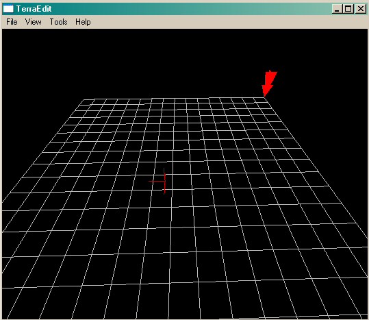
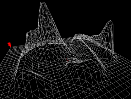
Heroes IV Editor view could be pretty fine, or something like TerraEdit:
http://cutvi.chez-alice.fr/Site/Images/ ... raedit.jpg
http://cutvi.chez-alice.fr/Site/Images/ ... ages04.gif
http://cutvi.chez-alice.fr/Site/Images/ ... raedit.jpg
http://cutvi.chez-alice.fr/Site/Images/ ... ages04.gif
Not really sure what you're suggesting with those two wireframes.
I was looking more for ideas like your "mountain brush".
I have made something similar based on your earlier suggestions.
A range height change tool (currently mapped to 9/lower, 0/raise; right next to -/lower single tile, +/raise single tile) that raises the center tile a lot, and the other tiles around it somewhat less out to the radius of the tool. It does build four-sided pyramid-like hills rather quickly
int heightAdjust = heightToolRadius - Math.max(Math.abs(x-i), Math.abs(y-j)) + 1;
where x,y is the center coordinate, and i,j are the tiles from negative heightToolRadius to positive heightToolRadius around that center.
I'm thinking that in addition to having an adjustable radius, we also might want to enable/disable automatic raising of sprites/bmodels/spawnpoints/etc on those tiles (keeping the same relative difference in height to the surface), and we will probably want to have the ability to specify the function used by the tool.
For example, using the actual distance between i,j & x,y rather than max h/v distance would result in round cones rather than square pyramids. There are probably other functions as well, but I don't know off the top of my head what's useful.
Another tool would probably be some kind of height-based tiling tool.
Pick a radius, and set what tiles show up at what heights. A really clever one would automatically pick the correct "edges" based on the other tiles outside of the radius.
At some point, I guess I need to consider multiple-tile selection, but I haven't really gotten to the point where I want to add support for that yet.
I accidentally created a waterfall ... or magic portal... in the mage camp in New Sorpigal using the cone area tool
http://picasaweb.google.com/mkienenb/MM ... 4159840850
http://picasaweb.google.com/mkienenb/MM ... 4159840850
-
vladimir-maestro

- Genie

- Posts: 1034
- Joined: 19 Jun 2008
it is a big mirror 
You can contact me here:
maestro_mod@yahoo.com
vladud @ yandex.ru - preferred one
---
Site about MODs: http://www.mmgames.ru
---
if you wish to upload some materials for this site - let me know.
maestro_mod@yahoo.com
vladud @ yandex.ru - preferred one
---
Site about MODs: http://www.mmgames.ru
---
if you wish to upload some materials for this site - let me know.
Who is online
Users browsing this forum: No registered users and 15 guests